Geophysics
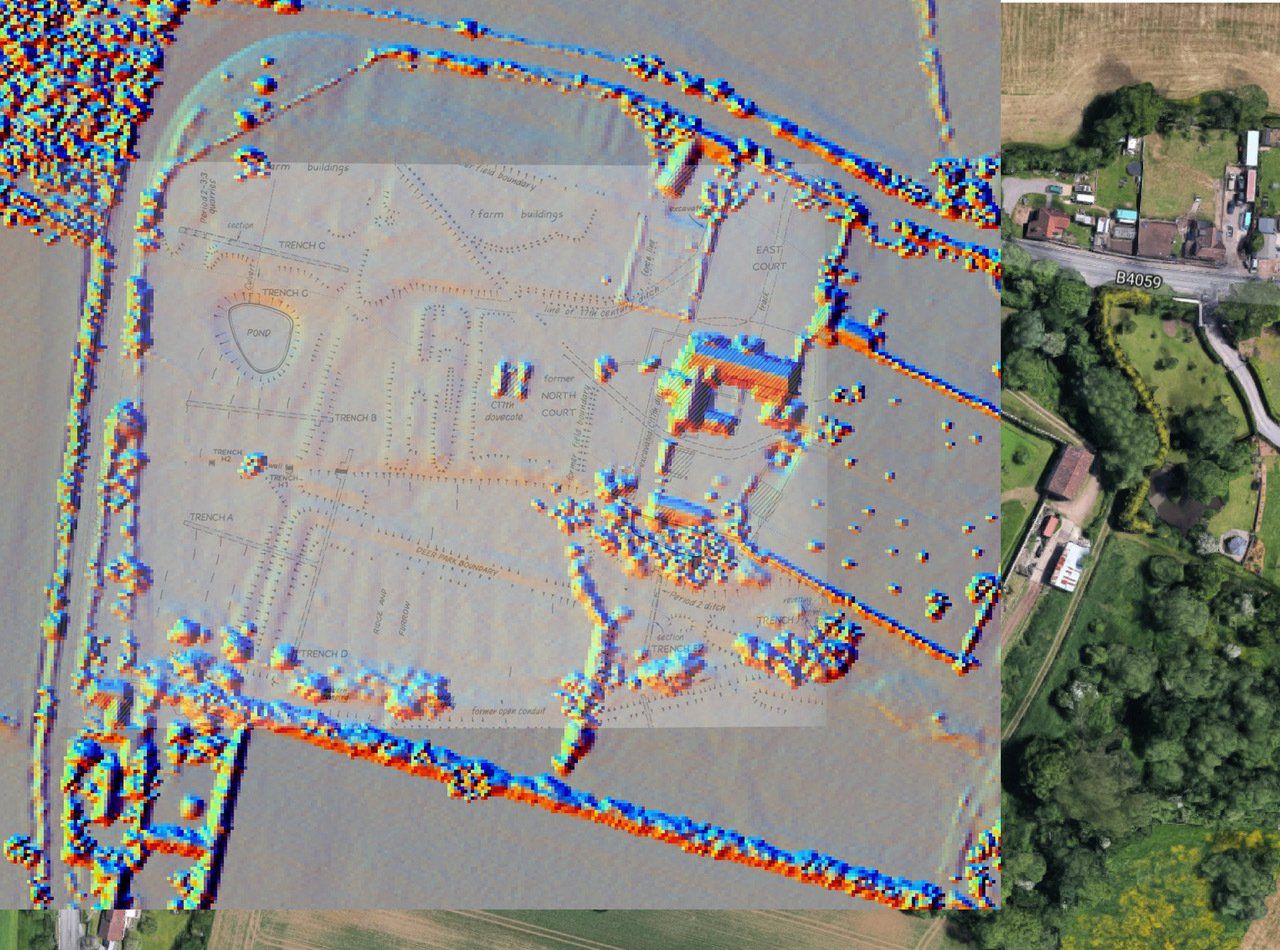
It has long been believed that at the time of Henry VIII and Anne Boleyn’s visit to Acton Court there would almost certainly have been a typical medieval garden in the area now known as the North Field. A garden of this type would have been surrounded by a wall with an elevated viewing gallery designed so that the garden could be viewed from above and the geometric layout of a series of small, rectangular or square beds could be best appreciated. The discovery of an early garden sundial, designed by Nicholas Kratzer in 1520, lends support to this theory.
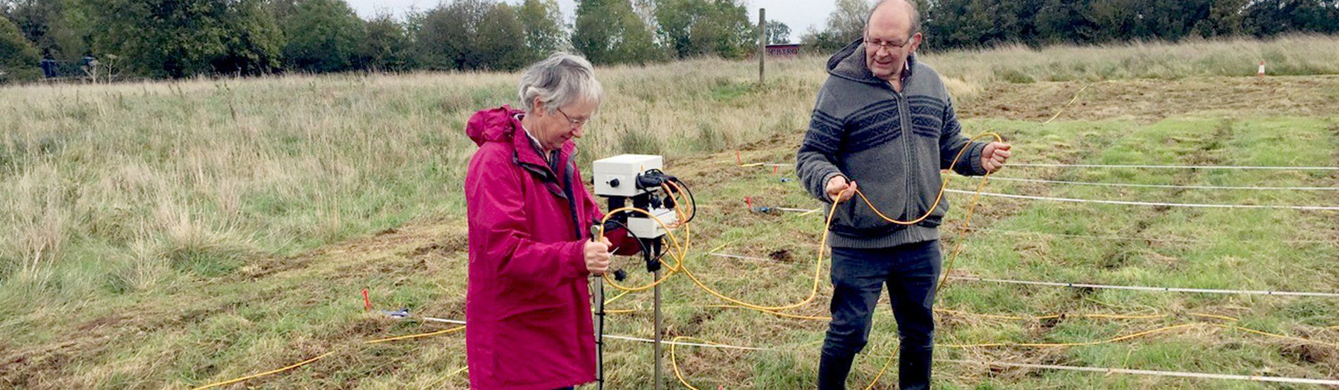
In 1987, an attempt was made to confirm the existence of the garden and to establish its design by using a non-destructive survey method known as a resistivity survey. A resistivity survey uses metal probes to pass a small electric current through the ground. If there are buried materials of high resistivity, for example wall foundations or hard floor surfaces, the readings that the survey measures will be very different from areas of low resistivity, which may result from wet areas or areas of disturbed soils such as infilled ditches. The survey team moves across the area of interest measuring the resistivity and the data is recorded in a data logger. Computer software can then convert the data into an image of the ground area covered, which can suggest what might lie under the surface. In the 30 or so years since the original survey, geophysical survey techniques and computer processing have improved greatly, so when the Yate and District Archaeology Group (YaDAG) were offered the opportunity to resurvey the North Field, the chance was seized to upgrade the earlier survey.
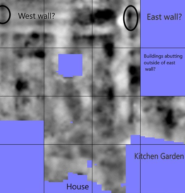
Because Acton Court is a site of considerable historic and archaeological interest, survey proposals had to be presented and Consent sought from Historic England. The grass had to be cut and survey grids laid out before any surveying could begin. Work was staggered to preserve the wildlife potential of the field and to ensure the local owl population and the voles they feed on were safeguarded. At the time of writing (March 2020), a dozen 20 metre square grids closest to the house have been surveyed. The image shows that a pattern of right-angled shapes is beginning to emerge and is annotated with a tentative interpretation of what can be see. When the weather improves, the survey will continue with more grids to the east and the north.
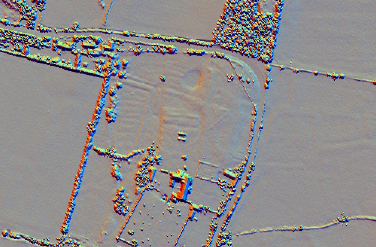
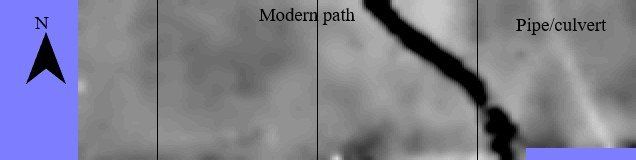
While time elapsed to protect the owls and their food supply, the survey was transferred to the South Court. The motive for surveying here was to look for the footings of the presumed medieval gateway and original entrance into the manor house complex and also to identify the footings of farm buildings known to have been in the South Court during the 19th century and possibly before. It was also known that the ground level within the South Court had been extensively modified on more than one occasion over the last few hundred years. Unfortunately, the remodelling seems to have completely eradicated all earlier structures except for an intriguing and previously unknown ditch, pipeline or culvert which can be seen as the lighter trace on the geophysics plot. If this feature extends beyond the existing plot, it may link the outer moat with the inner moat close to the house. The intention is to continue the survey back towards the manor house to try to cast more light on this unexplained feature.
The Yate and District Archaeology Group team have been professionally trained and have extensive experience of undertaking geophysical surveys at various sites locally. YaDAG also hosts a monthly programme of evening talks at Yate Heritage Centre. Anyone interested in discovering more about the group is welcome to attend an evening talk or contact us through our Facebook page at www.facebook.com/YateArchaeology.
Mary Lennox
Yate and District Archaeology Group